The Expanding Role of Drone Photography & Inspection Operators in Modern Industries
Drone Operators coordinate missions, property access, weather, aircraft checks, flight records, image files, delivery, and incidents. Learn how structured records support that work.
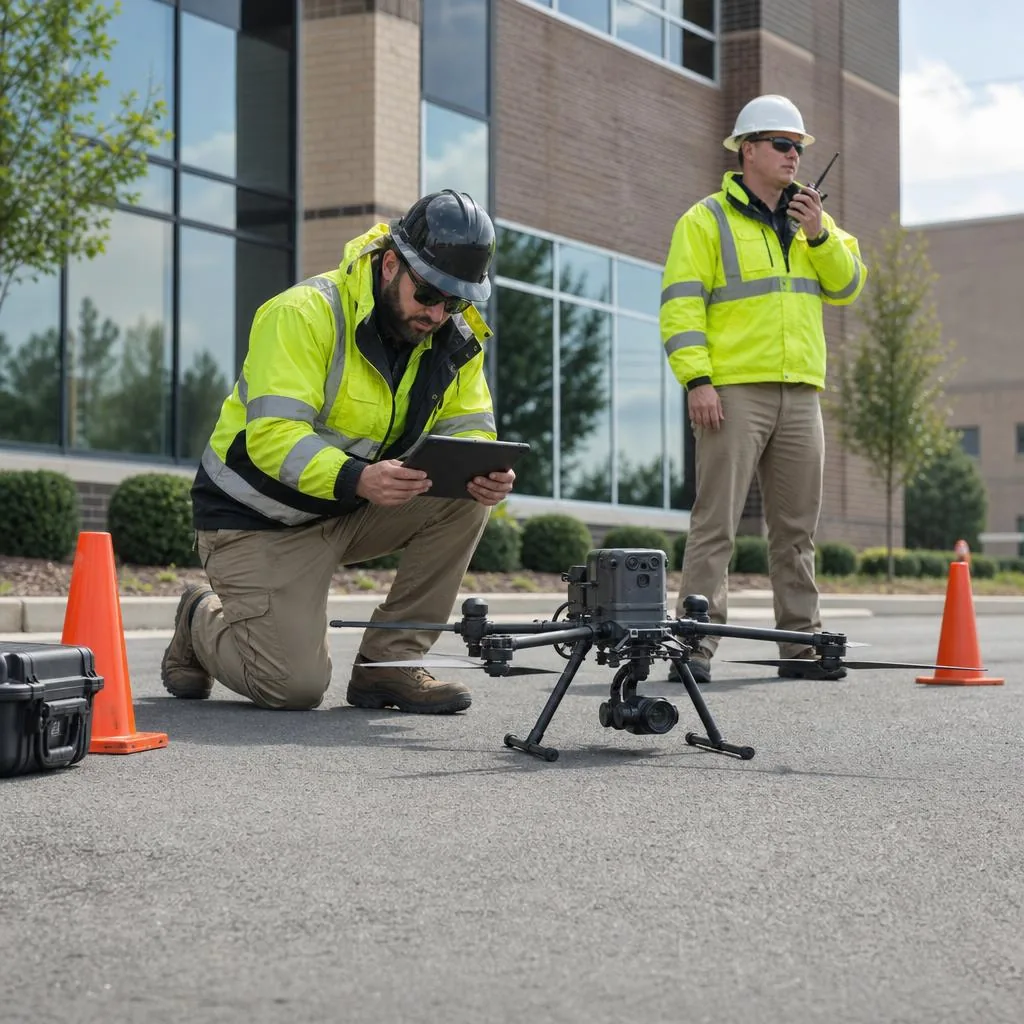
Small uncrewed aircraft can capture aerial photographs, video, and observational data for property marketing, construction progress, agriculture, environmental work, and selected inspections. Drone Photography and Inspection Operators coordinate each mission around the requested deliverable, site conditions, aircraft, people, airspace, weather, permissions, privacy, and safe operating limits.
A drone can provide a useful perspective, but it does not automatically replace a physical inspection, survey, engineering assessment, laboratory test, or specialist diagnosis. Operators should define what they capture, what they observe, and which conclusions must be made by an appropriately qualified professional.
What Drone Photography and Inspection Operators do
Depending on their qualifications and equipment, operators may plan missions, capture aerial images or video, document property or construction conditions, create organized image sets, collect mapping inputs, operate approved sensors, coordinate visual observers, log flights, process files, and deliver agreed media or observational records.
Roof, tower, bridge, utility, agricultural, thermal, mapping, insurance, emergency, night, controlled-airspace, beyond-visual-line-of-sight, populated-area, or other specialized work may require additional approvals, training, equipment, procedures, insurance, crew, or professional interpretation. Those capabilities should never be assumed from a general photography service.
Why structured drone operations matter
Aerial capture can reduce some access exposure
A drone may collect imagery without placing a person on a roof, tower, unstable surface, or difficult terrain. It does not eliminate all risk: launch areas, people, vehicles, obstacles, aircraft, weather, batteries, lost links, and property conditions still require active controls.
Useful data depends on mission design
Resolution, distance, angle, overlap, lighting, sensor settings, location accuracy, weather, obstructions, and processing affect the result. A client and operator should agree on the capture need before flight rather than assume any aerial image supports precise measurement or diagnosis.
Cost comparisons depend on the assignment
Drone capture may reduce the need for some access equipment or repeat visits, but it can also require permissions, specialist sensors, crew, travel, site controls, processing, or another professional’s review. Cost and suitability should be evaluated for the actual mission.
Aerial media supports visual communication
Properties, landscapes, venues, and construction progress can be shown from perspectives unavailable at ground level. Marketing use still requires truthful presentation, appropriate permissions, privacy review, and any disclosures that apply to edited or representative imagery.
Aviation and privacy requirements continue to evolve
Aircraft registration, operator certification, operating categories, airspace authorization, remote identification, visual-line rules, site restrictions, privacy, recording, and local permissions vary by jurisdiction and mission. A reusable form does not authorize a flight.
The documentation challenge
Drone projects can involve mission purpose, property location, client contacts, requested views, site access, adjacent areas, people, hazards, airspace, weather, aircraft, registration, crew, planned controls, flight activity, image files, observations, delivery, retention, deletion, and incidents.
The client may control the property but not the surrounding airspace, neighboring property, roads, people, protected sites, or every required permission. Property authorization and aviation authorization are different records and may both be insufficient without further review.
Templates provide structure, but they do not grant airspace access, certify a pilot, guarantee flight approval, eliminate operational risk, establish survey-grade accuracy, validate thermal or structural conclusions, prove regulatory compliance, determine claim coverage, or transfer all liability.
Documents that support a drone workflow
Drone mission and location intake
An intake can identify the client, property, mission purpose, requested capture or observation, planned window, site contacts, access, people, livestock, neighboring concerns, obstacles, restricted areas, deliverables, deadlines, and information supplied by the client.
Drone services agreement
The agreement can define the requested service, deliverables, schedule, fees, client responsibilities, site access, weather rescheduling, revisions, file use, licensing, retention, cancellation, and the limits of photography, observation, measurement, or interpretation.
Property and privacy authorization
Authorization can record the property contact, access permission, launch and recovery area, privacy instructions, adjacent-property concerns, occupancy, recording restrictions, authorized contacts, and the client’s responsibilities. Separate permissions or legal requirements may still apply.
Preflight and weather checklist
A preflight record can cover aircraft condition, firmware or configuration, batteries, controller, propellers, payload, registration reference, site hazards, weather observations, airspace review, crew briefing, emergency actions, planned controls, and the operator’s go or no-go decision.
Flight activity log
A flight log can record the date, location, aircraft, crew, purpose, launch and recovery times, observed weather, operating conditions, interruptions, battery use, anomalies, and completion without substituting for any mandatory aviation record.
Aerial image and file index
An index can connect files to the mission, capture area, date, sequence, sensor, notes, client request, processing status, and review limitations. It should distinguish source files, edited media, derived products, and observational annotations.
Data delivery and retention record
A delivery record can identify the files, format, transfer method, authorized recipient, delivery date, access controls, license or permitted use, open items, backups, retention period, and approved deletion or archive instructions.
Flight, property, or privacy incident report
A separate report can document an aircraft event, lost link, unexpected person or aircraft, property damage, injury, flyaway, privacy concern, lost file, battery issue, weather change, immediate action, notifications, evidence, and follow-up without determining regulatory reporting duties.
How strong documentation supports the service
Coordinated records help operators screen missions, confirm the requested capture, document permissions and site information, prepare the aircraft and crew, record actual flight activity, organize files, explain limits, and complete a secure delivery and retention process.
Images, video, location information, property details, people, vehicles, access points, infrastructure, and inspection observations may be sensitive. Operators should minimize unnecessary capture, control access, secure transfers, follow retention instructions, and use a defined process for privacy or security concerns.
Build a repeatable drone workflow
A practical workflow follows the mission: define the deliverable and service boundary, gather site and client information, review property access and privacy, determine the applicable aviation pathway, assess airspace and conditions, plan crew and controls, inspect the aircraft, make a go or no-go decision, log the flight, index the files, document incidents, deliver approved outputs, and close retention or deletion steps.
Template Pro-Suite’s Drone Photography / Inspection Operator Starter Kit brings profession-specific agreement, authorization, intake, preflight, flight, file, delivery, incident, billing, and business records into one coordinated workflow. Review the included documents and adapt them to your aircraft, sensors, qualifications, missions, clients, insurer, aviation authority, and location.
Frequently asked questions
Does property-owner permission authorize a drone flight?
Not by itself. Property access, airspace, aviation rules, local restrictions, privacy, protected sites, people, and the planned operation may require separate review or authorization.
Can drone imagery replace a licensed survey or specialist inspection?
Not automatically. Imagery may support observation or analysis, but survey, engineering, structural, thermal, insurance, environmental, agricultural, or other conclusions may require specified methods and appropriately qualified professionals.
Can an operator guarantee that weather will allow the mission?
No. The operator should retain final go or no-go authority and use a documented rescheduling or cancellation process when wind, visibility, precipitation, temperature, airspace, site activity, or another condition is unsuitable.
Clear records support responsible aerial work
Drone Photography and Inspection Operators connect client objectives, properties, airspace, aircraft, crews, images, observations, and data delivery. Organized documentation keeps the mission purpose, permissions, conditions, decisions, activity, files, limitations, and incidents easier to understand.
Editorial note: This article provides general operational information, not aviation, legal, privacy, surveying, engineering, structural, thermal, insurance, environmental, agricultural, safety, or regulatory advice. Requirements and appropriate practices vary by aircraft, sensor, operation, airspace, site, data, client, professional qualifications, authority, and location.